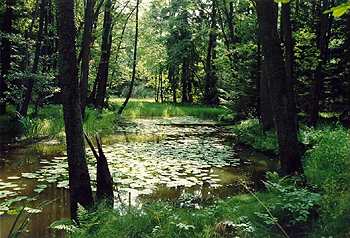
Reference area NP ŠUMAVA (CZ/G)
Problems description
 The problems of reference area National Park Šumava (NP Šumava) were discussed with local, regional and national representatives on End Users Workshop which was held in February in Prague as well as on separate talks and meetings.
Probably the most acute weakness of the Šumava region is a set conflicts of interests related to different approaches to land-use
from the sides of landscape protection institutions and regional development strategies represented by municipalities and
development agencies. There is a need for defining the optimal balanced land-use respecting the biological capacity of the
landscape and evaluating the impacts of an social and economical interference on the environment. This set of problems can be
represented by specific examples (plan for building a new border crossing or a skiing piste in protected zones of the National
Park Šumava). Both the mentioned problems have cross-border relevance. The problems of reference area National Park Šumava (NP Šumava) were discussed with local, regional and national representatives on End Users Workshop which was held in February in Prague as well as on separate talks and meetings.
Probably the most acute weakness of the Šumava region is a set conflicts of interests related to different approaches to land-use
from the sides of landscape protection institutions and regional development strategies represented by municipalities and
development agencies. There is a need for defining the optimal balanced land-use respecting the biological capacity of the
landscape and evaluating the impacts of an social and economical interference on the environment. This set of problems can be
represented by specific examples (plan for building a new border crossing or a skiing piste in protected zones of the National
Park Šumava). Both the mentioned problems have cross-border relevance.
 The interferences in protected zones are expected to have positive impacts on economical and social development of the region (tourism, employment, cross-border contacts) but have also negative impacts on valuable ecosystems biological stability.
Socio-economic difficulties in the region refer to historical development after World War Two. The establishment of border zone, military bases and training grounds together with forced evacuation of German inhabitants led to the dramatic decrease in population. Many villages have been abandoned or destroyed. The population density is the lowest in Czech Republic. The recent concentration of economical activities in large centres together with movement of the people from villages to cities is a cause of the countryside being relatively undeveloped with poor infrastructure and public service utilities and insufficient employment opportunities (about 8% of unemployment in 2000). The population distribution is unbalanced.
There are also water management problems in Šumava, which are related to the lack of water treatment facilities mainly in small villages, lowered water retention capabilities of the landscape and risk of floods. No proper water management study for
the area is available. The interferences in protected zones are expected to have positive impacts on economical and social development of the region (tourism, employment, cross-border contacts) but have also negative impacts on valuable ecosystems biological stability.
Socio-economic difficulties in the region refer to historical development after World War Two. The establishment of border zone, military bases and training grounds together with forced evacuation of German inhabitants led to the dramatic decrease in population. Many villages have been abandoned or destroyed. The population density is the lowest in Czech Republic. The recent concentration of economical activities in large centres together with movement of the people from villages to cities is a cause of the countryside being relatively undeveloped with poor infrastructure and public service utilities and insufficient employment opportunities (about 8% of unemployment in 2000). The population distribution is unbalanced.
There are also water management problems in Šumava, which are related to the lack of water treatment facilities mainly in small villages, lowered water retention capabilities of the landscape and risk of floods. No proper water management study for
the area is available.
Problem analysis:
| 1. Land-use problems due to: |
- conflicts of interests between development activities (tourism, industry, agriculture, infrastructure demands) and environment protection
- discrepancies between land-use approaches on Czech and German sides
|
| 2. Water management problems due to: |
- lack of water treatment facilities
- low water retention capacity of the landscape inducing the risk of floods
- unavailability of water management strategy for the region
|
| 3. Ecosystem problems due to: |
- excessive tourism
- recreational facilities, cross-border activities, agriculture in foothill areas
- bark-beetle
|
| 4. Socio-economic problems due to: |
- very low population density
- ow level of education, unemployment
- historical development
- unbalanced settlement structure
- conflicts between regional development and landscape protection
|
| 5. Development problems due to: |
- very low population density
- low level of education
- poor infrastructure and public services
- departure of military forces that provided
- direct or indirect jobs for local inhabitants
- unbalanced settlement structure
|
National Park Šumava
 As a Czech-German transboundary locality the National park Šumava was selected, mainly for two following reasons: As a Czech-German transboundary locality the National park Šumava was selected, mainly for two following reasons:
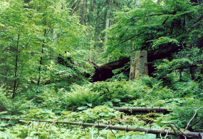
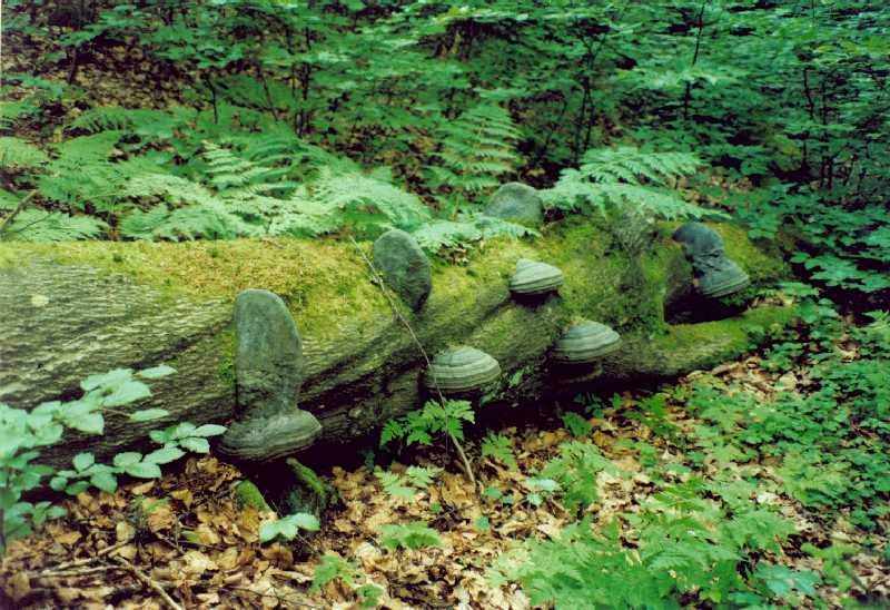
1) It is a specific and unique natural unit, which is characteristic by series of problems, connected with its
protection (these problems consist mainly in changes of ecosystems caused by preceding management and generally
negative interventions of inhabitants into the natural environment).
2) Majority of land, where the National Park Šumava is situated, is state owned, and the land is not fully exposed
to the process of privatization and parceling. This enables orientation of its management without taking the production
approach as a basic motive for his activity in the area of the National Park Šumava. The forest and agricultural production
is performed at about three quarters of the NP Šumava area, only as a secondary effect of care of the ecosystems; its
protection, maintenance, or coordination.
NP Šumava was established by Regulation of the Government of the Czech Republic No. 163/1991 Coll., by which the National Park Šumava is established, and conditions are determined for its protection (dated March 20, 1991). The main subject for protection in the NP Šumava is: the typical ecosystems in all of their components, and process of their natural development.
The land of NP Šumava is located along the South border of the Czech Republic. Main part of NP is located at the territory of the districts Klatovy and Prachatice; the smaller one is at a part of the district Český Krumlov. The protection zone of the National Park was not determined, but its role is played by the Protected Landscape Area, which is surrounding land of the national park. Total area of the NP Šumava is about 680 km2.
Šumava belongs among largest and oldest mountains in the Central Europe, with extensive relicts of high plains, located in several levels at 1,000 m above mean sea level. In the mountains Šumava, which have a distant geomorphologic position against the main European erosion bases, the European water divide between the Black and North Sea is located. Present-day relief of Šumava is a result of intensive impact of processes of tropical weathering during the preceding denudation cycles. In Pleistocene period the prevailing processes were cryogenic and glacial ones.
The study area shows two climatic zones. The apical parts belong among slightly cool to cool climate with enhanced precipitation. Precipitation at elevations above 1000 m a.s.l. exceeds in long-run monitoring 1000 mm. Due to relatively low mean temperature around 5 °C), the precipitation remains in form of snow for considerable part of the year. The foothills are warmer with mean temperatures around 7 °C and average rainfall around 600 mm.
From the of regional geology point of view, territory of the National park Šumava is built by two basic geological units - moklanubicum and moldanubic plutonic rock. The term moklanubicum is used for a group of medium and strongly reworked rocks, with prevalence of paralueses and migmatites, often with intercalated beds of quartzites and erlans. In the given territory they are assigned to so called subdued unit. The moldanubic plutonic rock is in the Šumava branch represented by several larger granite massifs of Variscan age. Quaternary sediments are represented mostly by diluvial (slope) sediments of gelifluction origin. Very frequent are here turfs, less frequent then fluvial and deluvium-fluvial sediments, rarely also sediments of glacial origin. Stratigraphically the belong mostly to Pleistocene and partly to Holocene till Recent. Composition of slope sediments is quite fluctuating and ranges from clays through clayish sands to clayish stone sediments up to block sediments of various thicknesses. The seas of rock are usually based at frost cliffs. Significant tectonic systems are the fault zones, oriented WNW-ESE, NNW-SSE (up to N-S) and NNE-SSW. Their age is considered to be young Paleozoic to tertiary.
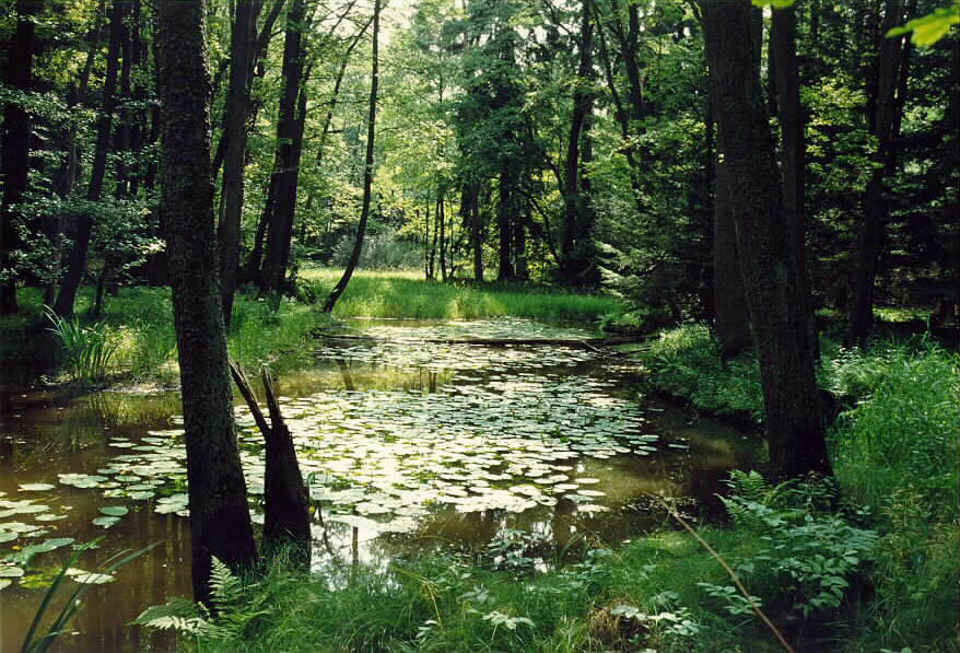
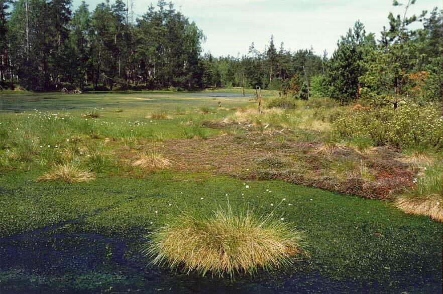
System of natural surface waters at NP Šumava consists of spring areas and moor lands, network of water streams and glacial lakes. This system is complemented by artificial waterworks, as shipping canals and headwater channels and artificial reservoir (former navigation pools, fishing reservoirs, or dams).
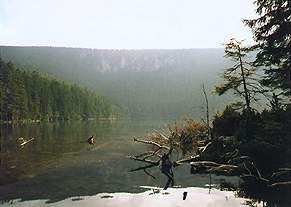
The whole territory of the National Park Šumava is included in Natural Water Accumulation Protected Area (NWAPA), which almost identically corresponds with boarder of Protected Landscape Area (PLA) Šumava (by Regulation of Government No. 40/1978 Coll.), according to the Law No. 138/1973 Coll. on waters. From the hydrological point of view, major part of territory belongs to drainage area of the North Sea, catchment of Labe with the main rivers Vltava and Otava. The river Otava is draining the West part of NP Šumava. It originates by junction of two significant rivers - Vydra and Křemelná. The river Vltava drains waters from the South Bohemian part of NP Šumava, and springs as Černý stream on the East Side of the Černá mountain. The specific hydrological phenomenon at Šumava are natural glacial lakes, appearing in the altitude of about 1,000 m. Their condition is currently influenced by degree of acidification, resulting from acid deposition and natural conditions of the lakes.
Territory of Šumava as a unit is characterized by relatively monotonous hydrogeological conditions, whose uniformity is given by the fact that the territory is built by consolidated, intensively plicated through metamorphic rocks of moldanubicum and migmatites of moldanubic pluton. This rock formation features by only fracture permeability. Interstitial water-saturation, with sources of ground water mainly of only local significance, is related to the weathering cover of rock massif, and to deluvial, deluvio-fluvial, and fluvial sediments.
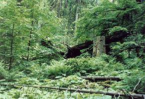
History of design of cultivated landscape of Šumava may be divided into several relatively clear time blocks. Šumava did not suffer by primeval and early medieval deforestation. Anthropogenous creation of unstocked forest land is dated into 12th and 13th centuries, when the high-medieval colonization started. Until the year 1,500 the settlement network is thickening and stabilizing in the foreland of Šumava. Till the year 1,700, the settlement penetrated at several places into the inner part of Šumava, mainly along the former kingdom paths. Final wave of settling entered the "forest" approximately in the middle of 18th century, in connection with development of glass industry and timber harvesting. Total devastation on many places reached so far that in the 19th century a planned restoration and regeneration of forests of Šumava was started. The spill-over of inhabitants from Šumava was accelerated by migration of nations in time of WWII (withdrawal of Czechs before the war and Germans after the WWII). In this period, also due to the "Cold War", a special border zone and military areas were established at Šumava. In this area, the existing settlement structure was practically liquidated. Reduction of permanent settlement in the region of Šumava caused a shortage of manpower in agriculture, forestry, and some of branches of secondary industry. Displacement of inhabitants led also to substituting the manpower by large-scale production technologies with direct and indirect impact on the natural environment (processes of development of forest exploitation, merge of fields, higher concentration of animals, soil amelioration, soil fertilization, etc.). The basic part of so far agriculturally utilized landscape was left useless and in the current landscape, its covering by the woody plants (succession areas) prove existence of renaturalization process.
In the last years (after the year 1989 and after accessibility to the border zone) a great increase of recreational use of the land occurred. Pressure on recreational use of the land is still increasing, as well in summer and winter activities.
End of 20th century was lead by effort to complete settlement of some parts of Šumava (Prášily). In the year 1991 took place a population census. According to data from this time, at the territory of NP Šumava, there were 36 settlement communities of various size, administered by 7 villages inside of NP Šumava and by 4 villages on its limits. In the villages inside the NP, there were 877 inhabitants living. Density of inhabitants in NP did not exceed 1.3 inhabitants per square km. In case of including also villages on the border of NP, the total number of inhabitants in the year 1991 was equal to 2027.
Stakeholders List for Šumava Reference Area (CZ/G)
| Stakeholder |
Responsibility |
Contribution |
| 1. National Park and Protected Landscape Area Šumava |
- environment and landscape protection administration
- water and land management, fishery, hunting, soil protection, tourism, traffic administration
and research
|
- provide data landscape
- define environmental problems
- improvement of cross-border coordination
|
| 2. Regional Development Agency Šumava |
- management of regional development and agriculture programs
- formulation of regional strategic plans and documents
|
- provide data
- define socio-economic problems of the area
- formulation of regional strategic plans and documents
|
| 3. Community of Villages of Šumava |
- representation of more than 30 villages of Šumava in question of tourism,
development, environment and cross-border cooperation
|
- define development problems
- direct access to other end users - municipalities
- cross-border contacts
|
| 4. University of Southern Bohemia |
- educational and research institution
|
- provide data
- define general problems of the region
|
| 5. Forest Management Institute |
- elaboration of Forest Inventory
- elaboration and management of data for Regional Plans of Forest Development, Forest management Plans
|
- provide existing database
- define forestry problems
|
| 6. Ministry of Environment |
- state administration and management of environment
- regional agencies for environmental support programs
|
- provide data
- define environmental issues of the region
- support for dissemination the projects
|
| 7. Ministry for Regional Development |
- state administration on regional development activities, incl. development programs
- regional agencies
|
- acces to regional agencies, data holders
- define national strategies of development of the region
- dissemination support
|
| 8. Ministry of Agriculture |
- state administration of agriculture, support programs, regional agencies
|
- acces to regional agencies, data holders
- define national strategies for agriculture in the region
- dissemination support
|
International importance and relations of NP Šumava
The international relations, related to the existence of NP Šumava, reflect importance of location of NP Šumava in the center of Central Europe and are pointed out by excellent natural values, concentrated in the largest continual complex of woods in the Central Europe, and also by concentration of all types of large-scale protected areas on both sides of the Czech-German border (bilateralism of NP Šumava and Nationalpark Bayerischer Wald, as well as biosphere preserves Šumava and Bayerischer Wald, existence of Protected Landscape Area Šumava as a protective zone of NP on the Czech side and a similar category Naturpark Bayerischer Wald surrounding the NP Bayerischer Wald). It clearly shows a high supra-national importance of the whole region Šumava-Bayerischer Wald, regardless to the state borders).
Preservation of quality of this natural area for the future is therefore a basic framework for all approaches related to the both national parks, but also to their adjacent surroundings.
Reference area TŘEBOŇ BASIN BR/PLA (A/CZ)
Problems description
 The main problem in Třeboňsko BR/PLA (BR - Biosphere Reserve, PLA - Protected Landscape Area) is a quality of surface water. This problem is caused by results of human activities during the last decades including eutrophication and loss of biodiversity due to intensive fish-farming and agriculture, changes in water regime due to drainage ("ammelioration") of soils and intensive mining of peat, sand and gravel. The loss of biodiversity of meadows is caused by the lack of proper management (regular mowing) related to social and economic changes in agriculture after the change of the regime in Czech Republic. The excessive tourism near major recreational centres induces a pressure on environment, especially in protected areas of unique wetlands. The industry in Třeboňsko and cross-border transport of the pollutants also contribute to the water pollution. Water treatment in many settlements is unsatisfactory. The main problem in Třeboňsko BR/PLA (BR - Biosphere Reserve, PLA - Protected Landscape Area) is a quality of surface water. This problem is caused by results of human activities during the last decades including eutrophication and loss of biodiversity due to intensive fish-farming and agriculture, changes in water regime due to drainage ("ammelioration") of soils and intensive mining of peat, sand and gravel. The loss of biodiversity of meadows is caused by the lack of proper management (regular mowing) related to social and economic changes in agriculture after the change of the regime in Czech Republic. The excessive tourism near major recreational centres induces a pressure on environment, especially in protected areas of unique wetlands. The industry in Třeboňsko and cross-border transport of the pollutants also contribute to the water pollution. Water treatment in many settlements is unsatisfactory.
The fishing in Třeboňsko is one-handed oriented on carp. This sidedness fish-farming orientation is a potentional threat for economical and social stability of the region. Quality of water in many ponds in the area is poor due to carp breeding. It retrospectively influences the fish-farming and also biodiversity of the ecosystem.
Problem analysis:
| 1. Water quality problems due to: |
- intensive fish-farming (carp breeding)
- agricultural activities using fertilizers and pesticides
- peat, sand and gravels mining
- excessive recreational activities
- direct contamination by the industry and settlements on the Czech side
- transport of the pollutants from the Austrian side
|
| 2. Problems in the ecosystem due to: |
- water quality problems
- changes in water regime - amelioration
- excessive tourism
- lack of proper management of meadows
- peat, sand and gravels mining
|
| 3. Socio-economic problems due to: |
- low level of public services and infrastructure in comparison with the Austrian side structural changes in industry and agriculture
|
| 4. Development problems due to: |
- unbalanced development of one-sided economical activities
- decrease in population during last years
- low human potential in relation to population structure and the level of education
- conflicts between the economical development and environment protection
|
Protected landscape area Třeboňsko
 Třeboňsko is a Austrian-Czech reference area because of its unique character of area that was intensively impacted by human activities since middle ages. Třeboň Basin is one of the most important Czech Protected Landscape Areas, preserving both natural and cultural resources (urban and rural architecture, traditional land use etc.). For many centuries Třeboň Basin was an example of sustainable local economy using sensitively and rationally the landscape and local natural resources (fish-farming in ancient system of artificial fishponds, agriculture, forestry, extraction of peat and sand). Several years ago, Třeboň Basin BR was chosen as a model area for a project of ecological optimization of local economy. Třeboň Basin is an important study and experimental area for biological (ecological) research and monitoring and it is designated as a LTER (Long Term Ecological Research) site. Třeboňsko is a Austrian-Czech reference area because of its unique character of area that was intensively impacted by human activities since middle ages. Třeboň Basin is one of the most important Czech Protected Landscape Areas, preserving both natural and cultural resources (urban and rural architecture, traditional land use etc.). For many centuries Třeboň Basin was an example of sustainable local economy using sensitively and rationally the landscape and local natural resources (fish-farming in ancient system of artificial fishponds, agriculture, forestry, extraction of peat and sand). Several years ago, Třeboň Basin BR was chosen as a model area for a project of ecological optimization of local economy. Třeboň Basin is an important study and experimental area for biological (ecological) research and monitoring and it is designated as a LTER (Long Term Ecological Research) site.
 The Biosphere Reserve and Protected Landscape Area is situated mostly in the shallow Třeboň Basin, a large flat depression (plateau) moderately inclined northwards. Mean altitude is 410 - 470 m a.s.l., with the highest points in the eastern part at about 550 m a.s.l. The Třeboň Basin is part of the Bohemian Massif, which represents the eastern limits of the Hercynian Platform. The Western flat part of the Třeboň Basin is formed by massive sediment layers (sands, sandstones, clays etc.) from the Secondary (Cretaceous) and Tertiary periods. This area is very rich in groundwaters. The eastern marginal hilly part of the Třeboň Basin is formed by crystalline rocks (gneiss, granite). There are large deposits of sand and gravel from the Quarternary along the rivers Lužnice and Nežárka (several hundred million tons), some of them are extracted by local industry (Štěrkovny a pískovny Veselí nad Lužnicí, Calofrig Nová Ves). Unique transitional (valley) peatbogs are another typical feature of the Třeboň Basin. 30% of all Czech deposits of peat are located in the BR, some of them are extracted by local industry (Rašelina Soběslav). The Biosphere Reserve and Protected Landscape Area is situated mostly in the shallow Třeboň Basin, a large flat depression (plateau) moderately inclined northwards. Mean altitude is 410 - 470 m a.s.l., with the highest points in the eastern part at about 550 m a.s.l. The Třeboň Basin is part of the Bohemian Massif, which represents the eastern limits of the Hercynian Platform. The Western flat part of the Třeboň Basin is formed by massive sediment layers (sands, sandstones, clays etc.) from the Secondary (Cretaceous) and Tertiary periods. This area is very rich in groundwaters. The eastern marginal hilly part of the Třeboň Basin is formed by crystalline rocks (gneiss, granite). There are large deposits of sand and gravel from the Quarternary along the rivers Lužnice and Nežárka (several hundred million tons), some of them are extracted by local industry (Štěrkovny a pískovny Veselí nad Lužnicí, Calofrig Nová Ves). Unique transitional (valley) peatbogs are another typical feature of the Třeboň Basin. 30% of all Czech deposits of peat are located in the BR, some of them are extracted by local industry (Rašelina Soběslav).
Stakeholders List for Třeboňsko Reference Area (A/CZ)
| Stakeholder |
Responsibility |
Contribution |
| 1. Protected Landscape Area Třeboňsko |
- environment and landscape protection administration
- water and land management, fishery, hunting, soil protection, tourism, traffic administration and research
|
- provide data
- define environmental problems
|
| 2. Regional Development Agency Southern Bohemia |
- management of regional development and agriculture programs
- formulation of regional strategic plans and documents
|
- provide data
- define socio-economic problems of the area
- formulation of regional strategic plans and documents
|
| 3. University of Southerm Bohemia |
- educational and research institution
|
- provide data
- define general problems of the region
|
| 4. Forest Management Institute |
- elaboration of Forest Inventory
- elaboration and management of data for Regional Plans of Forest Development, Forest Management Plans
|
- provide existing database
- define forestry problems
|
| 5. Rybářství Třeboň |
- private company enterprising in fishery in area of Třeboňsko
- management of 7440 hectares of ponds
|
- define problems of water management, land-use and socioeconomic issues
- provide data
|
| 6. Ministry of Environment |
- state administration and management of environment
- regional agencies for environmental support programs
|
- provide data
- define environmental issues of the region
- support for dissemination the project
|
| 7. Ministry for Regional Development |
- state administration on regional development activities, incl. development programs
- regional agencies
|
- acces to regional agencies, data holders
- define national strategies for agriculture in the region
- dissemination support
|
| 8. Ministry of Agriculture |
- state administration of agriculture, support programs, regional agencies
|
- acces to regional agencies, data holders
- define national strategies for agriculture in the region
- dissemination support
|
According to the classification of climatic zones in Central Europe, the Třeboň Basin BR mainly belongs to the moderately warm and humid region. In the central part (Třeboň), the mean annual temperature is 8 °C, with a mean January temperature of –2.8 °C, and a mean July temperature of 18 °C. Mean annual precipitation is 650 mm (600 - 700 mm depending on the altitude). Mean duration of snow cover is 50 - 60 days with a maximum of 20 - 30 cm of snow. Western and south-eastern winds prevail.
The natural river axis of the Třeboň Basin BR/PLA is the Lužnice River which drains this area and part of the adjacent Austrian territory, flowing in the northern direction - towards Vltava and Labe Rivers. The length of the Lužnice River in BR/PLA is 75 km. The upper reaches of the Lužnice River represent a valuable and unique phenomenon of a natural meandering stream surrounded by a wide floodplain, with about 500 pools and oxbows and various types of wetlands. The second important river is the Nežárka River, which drains the north-eastern part of the Třeboň Basin (34 km). Mean discharge of the Lužnice River at its confluence with the Nežárka River is 5.09 cubic metres per second; the discharge of the Nežárka River is 6.48 cubic metres per second. The water quality, according to different parameters and locations, can be classified between the 3rd and 5th class of the Czech system due to the pollution from Gmünd (Austria), Třeboň, Jindřichův Hradec, and from agriculture and fish-farming.
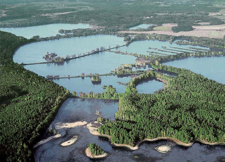
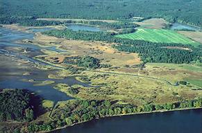 A significant feature of the Třeboň Basin BR/PLA is a unique system of artificial canals which fill and drain an extensive system of ancient fishponds (artificial lakes with areas reaching from 0.1 to several hundreds hectars, built mostly in the 14-16th century and used for local traditional fish-farming of carp Cyprinus carpio). The well-known canals are Nová řeka (New river - 13.5 km) and Zlatá stoka (Golden Canal - 47 km). There are 465 fish-ponds in the Třeboň Basin BR/PLA with total area of 7484 ha. The largest fish-pond is Rožmberk (658 ha, water area 489 ha). Other major fish-ponds include Horusický, Záblatský, Svět, Opatovický, Kanov, Velký Tisý, Hejtman, Staňkovský etc. The fishponds in the Třeboň Basin form sixteen hydrological systems, most of which drain to the Lužnice and Nežárka rivers. It is estimated that the flooded areas of these drainage basins add 390 million m3 of water to the discharge flowing past the mouth of the Nežárka river to Lužnice, and that this figure can be raised by 50 million m3. A significant feature of the Třeboň Basin BR/PLA is a unique system of artificial canals which fill and drain an extensive system of ancient fishponds (artificial lakes with areas reaching from 0.1 to several hundreds hectars, built mostly in the 14-16th century and used for local traditional fish-farming of carp Cyprinus carpio). The well-known canals are Nová řeka (New river - 13.5 km) and Zlatá stoka (Golden Canal - 47 km). There are 465 fish-ponds in the Třeboň Basin BR/PLA with total area of 7484 ha. The largest fish-pond is Rožmberk (658 ha, water area 489 ha). Other major fish-ponds include Horusický, Záblatský, Svět, Opatovický, Kanov, Velký Tisý, Hejtman, Staňkovský etc. The fishponds in the Třeboň Basin form sixteen hydrological systems, most of which drain to the Lužnice and Nežárka rivers. It is estimated that the flooded areas of these drainage basins add 390 million m3 of water to the discharge flowing past the mouth of the Nežárka river to Lužnice, and that this figure can be raised by 50 million m3.
The tradition of fish breeding that made the Třeboň region famous dates back many centuries, to the rule of Charles IV. By 1450, there were about 20 fishponds, with an area of 700 ha. The end the 15th century, and the 16th century, was the busiest period of fishpond construction. Well-known are names of important fish-pond builders of this era: Štěpánek Netolický, Jakub Krčín, Mikuláš Ruthard. Most of the fish-ponds are owned and operated by a joint-stock company (Třeboň Fisheries) at present. The majority of fishponds can be classified as eutrophic or even hypertrophic due to intensive fish-farming management (fertilizing, liming, high fish-stock).
There are two wetlands of international importance protected by the Ramsar Convention (Ramsar Sites) within the Třeboň Basin BR/PLA. Both sites consist of several locations. The first site, Třeboň Fishponds, was listed as Ramsar Site in 1990 soon after former Czechoslovakia had become a contracting party of the Convention. The second site, Třeboň Peatlands, had a temporary status of "Ramsar Site Candidate" and was officially listed as Ramsar Site in 1993.
In the Třeboň region, as throughout southern Bohemia, walled rural architecture is prevalent in the countryside. Even though high-rise buildings were constructed in villages and ancient farmhouses were inconveniently reconstructed into urban family houses in the period of large-scale agriculture between 1948 and 1989, many original farmsteads, chapels, forges, and wayside columns remain. Today, many villages preserve the Rural Baroque, a style of houses which spread over the northwestern and northern parts of the Třeboň countryside in the late 18th and early 19th centuries.
The Třeboň countryside, particularly the fishponds, provides a highly suitable environment for recreation: cycling, canoeing, mushroom picking, angling, hiking, and hunting. The main influx of tourists takes place during the summer holidays, when the ponds, sandpit lakes, and streams are suitable for swimming and boating. Lužnice river and associated parts of the Nová řeka canal and Nežárka river are among the most popular canoeing routes in the Czech Republic. Apart from these waterbodies, the vast forests are the most attractive recreation sites, and are visited by both hikers and bilberry-pickers, mainly on summer and autumn weekends. Visitors to the Třeboň countryside are attracted also by sightseeing at historical monuments.
Desirable ways of local development include reasonable forest management aimed at improving of the ecological stability of forests, low-intensity agriculture, sustainable low-intensity fish-farming, processing of local resources in local small-scale industry (timber, fish, agricultural products, sand), "soft" tourism including spa, agrotourism, cycling, hiking, horse-riding, accommodation in restored farmsteads and small villages, spa treatments, visits to traditional folk events, organization of conferences, and modern light industry with no negative impact on nature and landscape.
|